

Located in Pennsburg, Pennsylvania, at the juncture of Lehigh, Bucks, Montgomery and Berks Counties.
Montgomery County, Pennsylvania
Land Surveying in Lansdale, PA
Certified boundary, ALTA, topographic, and construction surveying from a Pennsburg-based firm with over 40 years of experience serving southeastern Pennsylvania.
Serving Lansdale & Montgomery County
Professional Land Surveying for Lansdale Projects
Horizon Engineering has provided land surveying services throughout southeastern Pennsylvania since 2001. Our office is in Pennsburg, at the junction of Montgomery, Bucks, Berks, and Lehigh Counties, which puts us close to Lansdale and the surrounding Montgomery County municipalities we serve.
We deliver boundary, topographic, construction, and specialty surveying for residential, commercial, industrial, municipal, and transportation projects. Our survey staff works directly alongside our civil engineering and land development teams, which means one firm can carry your project from the initial survey through site design, permitting, and construction.
Our crews hold all required government clearances to work in airports, schools, railroads, and high-security facilities. We are a SEPTA-approved vendor, have completed over 150 PennDOT projects statewide, and are DBE/WBE certified as a federally self-certified Woman-Owned Small Business. Those qualifications matter on public and institutional projects in Montgomery County.
If you are not sure which type of survey your project needs, call us. That is a short conversation we are happy to have at no charge.
What We Offer
Land Surveying Services in Lansdale
Our survey staff covers everything from a straightforward residential boundary retracement to complex ALTA surveys for commercial closings, transportation corridor surveys for PennDOT, and construction stakeout for active job sites. The following is a sample of our land surveying services.
Boundary & Topographic
The foundation of most land transactions and permit applications. Required before subdivision, financing, and most land development submissions in Lansdale Borough and Montgomery County.
- Boundary retracement surveys
- Subdivision surveys
- Topographic surveys
- Flood plain certifications
- Utility route surveys
- PA One Call coordination
- Environmental data collection
- Right-of-way acquisition services
ALTA/NSPS Title Surveys
Required by commercial lenders and title companies before closing. More comprehensive than a standard boundary survey. It identifies encroachments, easements, and anything that could cloud a title.
- ALTA/NSPS surveys to current minimum standards
- Encroachment identification
- Easement and ROW mapping
- Title report review
Construction Survey & Stakeout
Precise field layout for residential, commercial, and infrastructure construction. Our crews coordinate directly with contractors and project engineers.
- Building and utility stakeout
- Highway and roadway layout
- As-built surveys
- As-built plan preparation
- Anchor bolt surveys
- Auxiliary contractor support
- Permit plan preparation
Transportation & Infrastructure
Over 150 PennDOT projects completed statewide, including 30 bridge construction projects and 50 bridge as-builts. We are a SEPTA-approved vendor and hold government clearances for airports, railroads, and secure facilities.
- PennDOT and PA Turnpike surveys
- SEPTA approved vendor
- Bridge construction and as-built surveys
- Airport AGES and aerial easement surveys
- Airport facility construction support
- Railroad facility surveys
- Rails-to-Trails ROW acquisition
- Riparian surveys
General & Forensic Support
Boundary disputes, expert testimony, GIS facility mapping. Useful when a project hits a legal complication or a municipality needs reliable documentation for planning purposes.
- Boundary dispute resolution
- Expert testimony
- Title report review
- GIS facility mapping
- Forensic surveys
Municipal & Institutional
DBE/WBE certification and government security clearances make us a qualified option for public-sector and institutional projects in Lansdale Borough and Montgomery County.
- DBE/WBE certified for federal and state projects
- Permit plan preparation
- School and secure-site surveys
- Airport facility surveys
- Railroad facility construction support
Not sure which survey you need? Call us. It is a short conversation and there is no obligation.
(267) 923-8673Quick Reference
Which Survey Do You Need?
This covers the most common situations we see. If yours is not on the list, call us.
| Survey type | When you typically need it | Residential | Commercial | Municipal |
|---|---|---|---|---|
| Boundary survey | Fence install, lot sale, infill permit, neighbor dispute | ✔ | ✔ | ✔ |
| ALTA/NSPS survey | Commercial mortgage closing, title insurance, acquisition due diligence | - | ✔ | ✔ |
| Topographic survey | Site design, grading plan, stormwater management, ADA work | ✔ | ✔ | ✔ |
| Subdivision survey | Splitting a parcel, land development application | ✔ | ✔ | - |
| Construction stakeout | New building, addition, roadway, utility installation | ✔ | ✔ | ✔ |
| As-built survey | Post-construction documentation, certificate of occupancy, lender requirement | ✔ | ✔ | ✔ |
| Flood plain certification | FEMA flood zone mortgage, elevation certificate for insurance | ✔ | ✔ | - |
| Right-of-way survey | Highway project, roadway improvement, utility corridor | - | ✔ | ✔ |
About Horizon Engineering
Serving Lansdale and Montgomery County
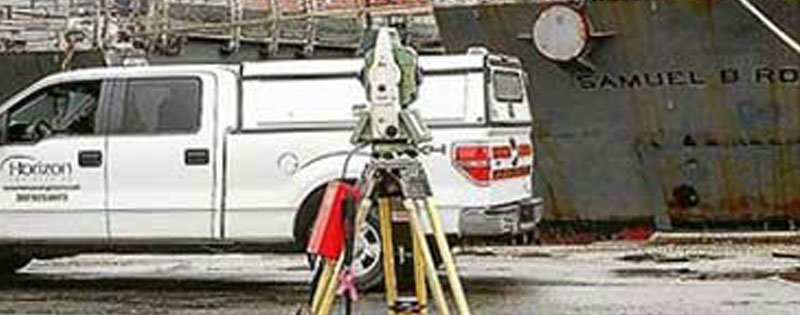
Horizon Engineering was founded in 2001 with the objective of creating a land development and professional site services firm that offers quality, thoughtful services in a timely and professional manner. That approach, doing what it takes to get the job done, has defined how we work across every project type and every county we serve.
Our team includes licensed professional engineers, professional land surveyors, and a registered landscape architect. We support residential, commercial, industrial, municipal, institutional, and public-sector projects, and we are integrated across service areas, so when your project needs both a survey and civil engineering support, those teams are working together from the start.
We serve clients in Montgomery County and throughout southeastern Pennsylvania. Our Pennsburg office is positioned at the junction of Montgomery, Bucks, Berks, and Lehigh Counties, which gives us strong regional familiarity and responsive service across all four counties.
Relevant Authorities for Lansdale Projects
Lansdale Borough · Montgomery County Planning Commission · Montgomery County Conservation District · PA DEP · PennDOT District 6-0 · PA Turnpike Commission
Montgomery County Municipalities We Serve
Lansdale · North Wales · Hatfield · Souderton · Harleysville · Pottstown · Norristown · King of Prussia · Montgomeryville · Upper Gwynedd · Towamencin
Professional Affiliations
ABC (Associated Builders and Contractors) · ASHE (American Society of Highway Engineers) · NSPS (National Society of Professional Surveyors) · PSLS (Pennsylvania Society of Land Surveyors) · APC (Associated Pennsylvania Constructors)
Our Office
428 Main Street, Pennsburg PA 18073
Mon-Fri 8am-5pm
(267) 923-8673
Certifications
Federally self-certified Woman-Owned Small Business · DBE/WBE certified in Pennsylvania · SEPTA Approved Vendor · Government clearances for airports, schools, railroads, and high-security facilities
Common Questions
Lansdale Land Surveying: FAQ
Yes. Lansdale Borough's Subdivision and Land Development Ordinance requires a certified boundary survey as part of any subdivision submission. Lot pins must be established, setback lines shown, and compliance with the Montgomery County Comprehensive Plan confirmed. We handle both the survey and land development application support, so you are working with one firm throughout.
A standard boundary survey establishes property lines. An ALTA/NSPS survey does that plus identifies easements, encroachments, access issues, and anything that could affect the title. All of this is documented to a nationally standardized format that lenders and title underwriters accept. If you are closing on a commercial property, your lender will almost certainly require an ALTA. A standard boundary survey will not satisfy that requirement.
Residential boundary surveys typically take 2-4 weeks from engagement to certified plat. ALTA and commercial surveys are usually 4-6 weeks. Deed complexity and current project volume are the main variables. We provide a specific timeline with your quote.
Yes. We have completed over 150 PennDOT projects statewide, including right-of-way acquisition surveys, highway construction stakeout, and bridge as-built documentation. We are also a SEPTA-approved vendor for transit infrastructure surveying.
We serve Lansdale and the surrounding municipalities throughout Montgomery County, as well as clients in Bucks, Berks, and Lehigh Counties from our Pennsburg office. Our location at the junction of all four counties gives us strong familiarity across the region.
Service Area
Other Communities We Serve
In addition to Lansdale, we provide land surveying throughout Montgomery County and southeastern Pennsylvania.
Also in Lansdale
Other Services from Horizon Engineering
Our surveying team works alongside our civil engineers, land development planners, and landscape architects. One firm, coordinated from survey through permit approval.
Horizon Engineering: What It Takes
Ready to move forward? Call us or submit a quote request and we will follow up during business hours. No obligation. Just a straight answer on what your project needs.
Request a Free Quote (267) 923-8673