
Why Your Surveyor and Civil Engineer Should Talk Before Site Design Begins
Why Your Surveyor and Civil Engineer Should Talk Before Site Design Begins
The short answer: Your surveyor and civil engineer should be talking before site design begins because the survey is the foundation every design decision is built on. Property lines, elevations, easements, and existing utilities determine where buildings, roads, and stormwater facilities can realistically go. When both teams coordinate from day one, you get fewer surprises, fewer return trips to the field, and less time spent passing messages between firms.
If you’re planning a land development project, you already have plenty to manage.
The last thing you need is your surveyor and civil engineer working in two separate worlds.
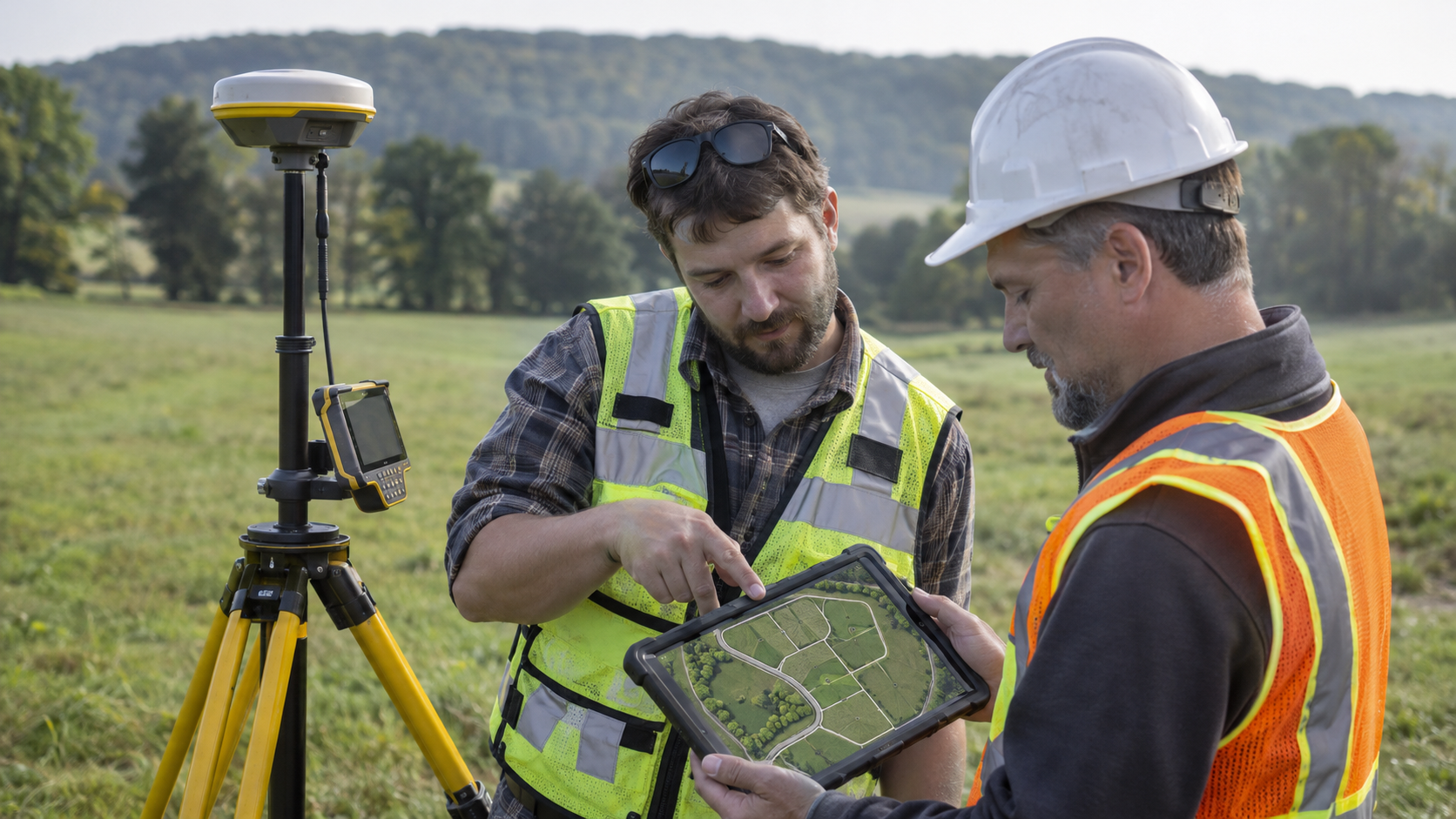
At Horizon Engineering, our land surveyors and civil engineers work side by side out of our office in Pennsburg, Montgomery County. We’ve seen firsthand how much smoother a project runs when those two groups are talking early and often. Here’s why it matters, and what to look for when you’re putting your project team together.
How Does a Land Survey Affect Civil Engineering Design?
A land survey tells your civil engineer what’s actually on the ground, and every design decision starts there.
Depending on the project, our surveyors may be preparing a boundary survey, a topographic survey, or both. That work documents things like:
- Property lines and corners
- Ground elevations and contours
- Existing buildings, pavement, and other improvements
- Easements and rights-of-way
- Visible utilities and drainage features
Our civil engineers take that information and start answering the bigger questions. How will the site be graded? Where will stormwater go? How will people get in and out? What will the township or borough require? And how do we make the proposed development work with the property as it really is?
You can probably see where this is going.
A two-foot change in elevation can reshape a drainage design. An easement can move a building pad or an access drive. An existing structure nobody mentioned can send the layout back to the drawing board.
Surveying and engineering aren’t separate pieces of the puzzle. They’re two parts of the same process, which is exactly why communication between them matters so much.
What Happens When Your Surveyor and Engineer Don’t Communicate?
When surveying and engineering happen in isolation, questions surface late, and the project owner usually ends up in the middle.
Here’s a common scenario: You’re developing a commercial property. Your surveyor finishes the fieldwork and sends the data to your engineer at another firm. The engineer starts the site design.
A few weeks later, a question comes up about an existing feature or a spot elevation the design depends on. Now there’s another phone call, another email, and maybe another crew trip to the property.
To be fair, some of that is unavoidable. Projects evolve, plans change, and new information needs come up along the way. That’s part of developing land.
But a lot of the back-and-forth can be prevented when the surveyor and engineer agree on what’s needed before anyone heads into the field. When they don’t, you can end up with:
- Delays while the design waits on missing information
- Repeat site visits that add cost
- Questions routed through you instead of directly between professionals
If you’re a developer or project manager already coordinating with contractors, municipalities, and other consultants, that’s one more thing on your plate. We think there’s a better way to work.
What Are the Benefits of Having Surveying and Engineering Under One Roof?
The biggest benefit is direct communication: the people gathering site data and the people designing with it can talk to each other without you relaying messages. At Horizon, that shows up in three practical ways.
We Start Talking Before the Design Does
Ideally, the surveyor-engineer conversation happens before the crew sets up the first instrument. What’s the goal for this property? What will the engineering team need? Are there existing conditions that deserve extra attention?
Getting aligned early doesn’t mean there won’t be surprises. It means we’re anticipating challenges together instead of reacting to them later.
Questions Get Answered Faster
Every project has questions. Maybe an engineer needs clarification on an elevation. Maybe the survey crew spots something in the field that should be looked at before design moves forward.
With both teams in-house, those conversations happen down the hall instead of through a chain of emails. For our clients, that means less time playing middleman between separate firms.
Each Team Knows How Its Work Affects the Other
A survey isn’t just a document to check off a list. It’s information that shapes the entire development. And engineering isn’t just lines on a plan. It’s finding practical solutions that fit the property, the client’s goals, and the municipality’s requirements.
Our surveyors know how their data will be used in design. Our engineers have direct access to the people who collected it. That shared understanding lets us work through challenges as one team.
Example: A Residential Subdivision in Montgomery County, PA
Picture a developer who wants to divide a larger parcel in Montgomery County into several building lots.
Before design gets too far, there are key questions to answer:
- Where exactly are the property boundaries?
- What’s the terrain like and where does water naturally flow?
- Are there easements or existing improvements that limit the layout?
- How will new roads, utilities, and stormwater facilities fit on the site?
Our surveyors establish the existing conditions. Our engineers evaluate how those conditions affect the proposed subdivision.
Maybe the topography makes one road alignment more practical than another. Maybe an existing easement shifts where a lot line can go. Maybe more elevation data is needed to size a stormwater basin.
When both teams work through those questions together, the plan that goes to the township is better informed from the start. It’s not about eliminating every unexpected issue. It’s about having the right people talking when those issues come up.
What to Ask Before Hiring a Surveyor and Civil Engineer in Southeastern Pennsylvania
Land development here is rarely simple. Every municipality has its own ordinances, review process, and expectations, and site constraints vary a lot from one property to the next. We work on commercial, residential, industrial, and municipal projects across Montgomery, Bucks, Berks, and Lehigh Counties. and we’ve learned that the project team matters as much as the plan.
So instead of simply hiring one firm for the survey and another for the site plan, ask these questions up front:
- Will the surveyor and engineer talk directly, or will information pass through me?
- Does the surveyor know what the engineer needs before fieldwork starts?
- Who is responsible for getting survey data into the design, and keeping it current?
- If a question comes up mid-design, how quickly can someone get answers from the field?
- Does the team have experience with the municipality where my property is located?
The answers will tell you a lot about how smoothly your project is likely to run.
Frequently Asked Questions
Can one firm handle both land surveying and civil engineering?
Yes. Many firms, including Horizon Engineering, offer professional land surveying and civil engineering in-house. For projects that need both, one firm can coordinate site data, design requirements, and municipal submissions directly which reduces delays and handoffs.
What's the difference between a land surveyor and a civil engineer?
A land surveyor measures and documents the property: boundaries, elevations, easements, and existing features. A civil engineer uses that information to design the site, including grading, stormwater management, access, utilities, and to prepare plans for municipal approval.
Do I need a survey before a civil engineer can design my site?
In almost every case, yes. Site design depends on accurate boundary and topographic information. Without it, an engineer can’t reliably plan grading, drainage, building locations, or setbacks.
When should my surveyor and civil engineer start working together?
Ideally Before fieldwork begins. A quick conversation about project goals and the engineer’s data needs helps the survey crew capture the right information the first time.
Does Horizon Engineering work outside Montgomery County?
Yes. We serve clients throughout eastern Pennsylvania, including Montgomery, Bucks, Berks, Lehigh, Northern Chester and the surrounding counties
Let’s Talk About Your Project
Planning a commercial development, residential subdivision, or site improvement in southeastern Pennsylvania? We’d be glad to talk through your plans, answer your questions, and help you figure out which surveying and engineering services you need.
At Horizon Engineering Associates, experienced surveyors and civil engineers work together to help you move your project forward.
Explore our civil engineering services · Explore our land surveying services · Contact Horizon Engineering